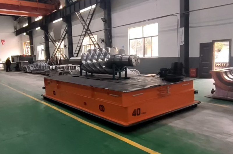
For years, putting a laser-navigated AGV into a factory meant one thing first: mounting reflector columns. Dozens of precisely surveyed reflective targets on walls and pillars, each one a point the vehicle triangulates against — and each one a maintenance liability the moment a rack blocks it or a forklift bends it. 3D SLAM navigation removes that infrastructure entirely. The AGV maps the building itself and navigates against what is already there.
For heavy-duty AGVs the stakes are higher than convenience. A 40-ton vehicle carrying a machine screw through a plant cannot wander, cannot lose position between zones, and increasingly has to cross from an indoor hall to an outdoor yard on a single task. This article explains how 3D SLAM works on a heavy AGV, why reflector-free matters at this scale, how RTK satellite positioning extends the system outdoors, and — honestly — what the accuracy figures do and do not mean.
What Is 3D SLAM Navigation?
SLAM stands for simultaneous localization and mapping: the vehicle builds a map of its surroundings and works out its own position within that map at the same time, using an onboard laser scanner. The “3D” matters. A 2D SLAM system sees one horizontal slice of the world at the scanner’s mounting height — a slice that changes every time a pallet moves. A 3D SLAM system scans a full point cloud: walls, roof trusses, columns, machine frames, from floor to ceiling.
That volume of data is what makes the method robust in a real factory. Pallets, people and trucks come and go at floor level, but the building’s structure — the geometry high above the traffic — barely changes. A 3D system matches against thousands of stable features at once, so no single blocked line of sight matters, and no reflector, magnetic tape, wire or floor QR code is ever installed. Among the navigation options for heavy AGVs — laser with reflectors, magnetic guidance, QR codes, RTK satellite — 3D SLAM is the only one that needs nothing added to the site at all.
Why Reflector-Free Navigation Matters for Heavy AGVs
No survey, no infrastructure, faster commissioning
Reflector navigation is accurate, but it front-loads a surveying project and permanently couples the AGV to wall hardware. A SLAM vehicle is commissioned by driving it through the plant once to record the map — then editing routes in software. Route changes never touch the building again.
Robust where heavy industry actually operates
Heavy plants are hostile to guidance infrastructure. Floor tape and QR codes are ground away by steel scrap, thermal cycles and wheel loads far beyond light-warehouse duty; buried magnetic wire cannot follow a re-routed line; reflectors disappear behind newly stored coils. The building frame that 3D SLAM navigates against is the one feature a metallurgy or fabrication shop cannot bury.
Freedom to use the whole floor
Because position is known everywhere on the map — not just along a guided path — a SLAM AGV exploits its omnidirectional steer-wheel drive fully: crabbing sideways into a tight station, rotating on the spot, taking a detour around a blocked aisle. For a vehicle several meters long carrying tens of tons, that maneuvering freedom often decides whether an existing building works at all.
How a 3D SLAM AGV Builds and Uses Its Map
Step 1: The mapping run
A technician drives the AGV through every area it will serve. The laser scanner streams point clouds; the software stitches them into one consistent 3D map, closing loops where routes reconnect so errors do not accumulate. The map is then cleaned — transient objects removed — and route networks, stations and speed zones are drawn onto it.
Step 2: Localization in operation
In service, the vehicle continuously matches its live scan against the stored map, fusing the match with wheel odometry and inertial data between scans. The output is a position and heading estimate updated many times per second — smooth enough to steer a multi-ton vehicle through 0-speed docking approaches without hunting.
Step 3: Living with change
When the plant changes — a new mezzanine, a demolished wall — the affected area is simply re-mapped and the map updated. Day-to-day clutter needs no action: the matcher ignores what does not fit the stable structure. This tolerance for change is the practical difference between a navigation system you commission once and one you maintain forever.
Indoor-Outdoor Operation and RTK Fusion
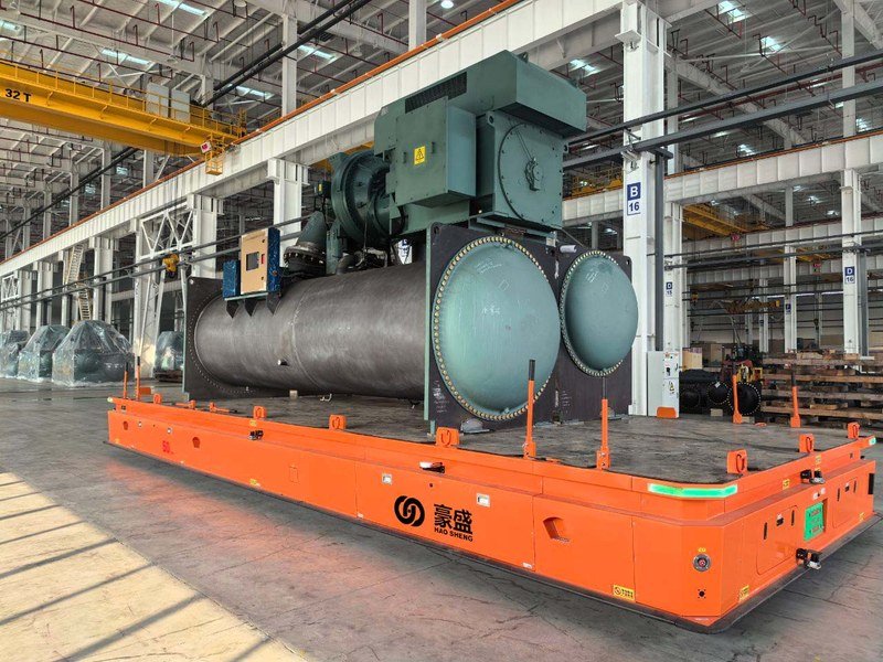
Many heavy loads live in two worlds: fabricated indoors, stored or shipped from an outdoor yard. Pure SLAM struggles in a large open yard for a simple reason — there is not enough structure to scan. A yard offers few walls, long sightlines and weather, so the point cloud gets thin exactly where distances get long. The answer is fusion with RTK satellite navigation, which provides centimeter-class global positioning outdoors using a correction base station.
A properly engineered indoor-outdoor AGV runs both systems and weights them by zone.
How the handoff works
Indoor zones
3D SLAM carries full authority; satellite signals are unusable under a steel roof and are ignored.
Transition zones
At doorways and canopies, the vehicle sees degraded versions of both signals, so the fusion filter blends SLAM, RTK, odometry, and inertial data — position never jumps, and the vehicle never stops to “switch”.
Outdoor zones
RTK dominates, with SLAM still contributing wherever buildings or structures border the route, and odometry bridging brief satellite outages.
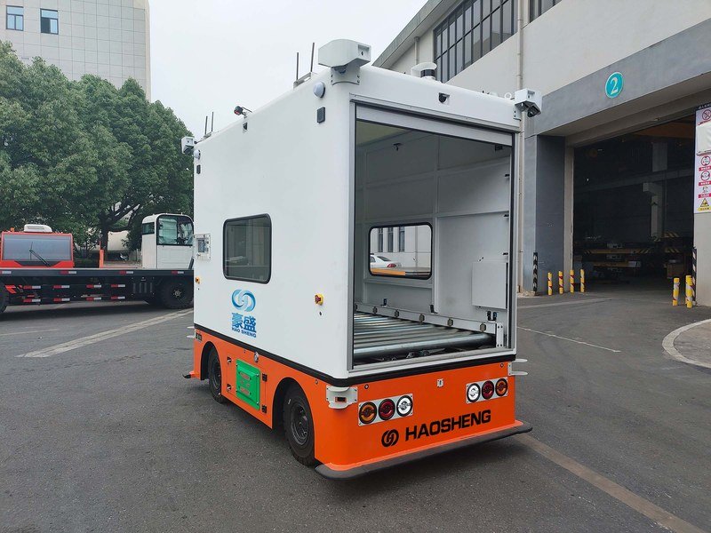
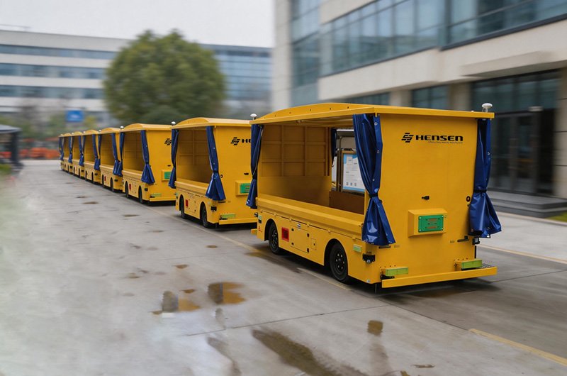
The result is one continuous map and one task: an AGV can collect a wind-power component indoors, cross the apron, and deliver to an outdoor stand in a single scheduled run — the pattern behind delivered projects like outdoor box-type AGVs and indoor-outdoor heavy transporters.
What the Accuracy Figures Really Mean
Marketing loves the phrase millimeter-level. Here is the honest version: a well-tuned 3D SLAM system on a heavy AGV positions the vehicle to about ±10–25 mm. That is millimeter-scale, and for a 40-ton trackless vehicle it is a remarkable figure — but it is not ±1 mm, and a buyer should know what governs it.
Where the tolerance comes from
The estimate inherits noise from every source: laser range accuracy, map quality, how much stable structure the environment offers, and how well the control loop translates position into steering on a vehicle whose polyurethane wheels are carrying enormous loads. Heavy AGVs actually help their own cause here — soft-started drives and low speeds make motion highly repeatable — but the ±10–25 mm envelope is the honest planning number for free navigation.
Designing stations around it
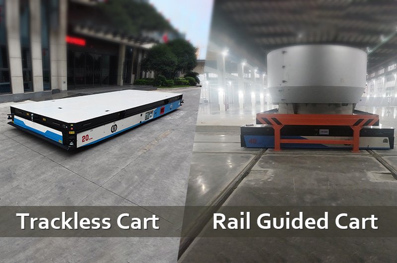
Good system design treats ±10–25 mm as the arrival tolerance, then closes the last gap mechanically or with local sensing: tapered guides and V-blocks on lifting decks, dock-mounted sensors for deck-to-deck transfer, camera or laser fine-positioning at stations that truly need tighter placement. That is standard practice, not a workaround — the same philosophy every docking machine uses. If your process needs rail-grade repeatability on every single stop, a rail guided vehicle may fit better; see our guide to RGV positioning technology for how carts on rails reach ±5 mm with RFID and laser ranging.
3D SLAM vs Other AGV Navigation Methods
| Method | Infrastructure | Typical accuracy | Best fit |
| 3D SLAM laser | None | About ±10–25 mm | Changing heavy-industry sites, indoor-outdoor routes |
| Laser + reflectors | Surveyed reflector columns | High, when reflectors stay visible | Stable indoor layouts that never block walls |
| Magnetic tape/wire | Tape or bury the wire on every path | Path-bound | Fixed simple loops, clean floors |
| QR code grid | Floor codes on a grid | High at each code | Light-duty warehouses with protected floors |
| RTK satellite | Correction base station | Centimeter-class | Outdoor yards and aprons |
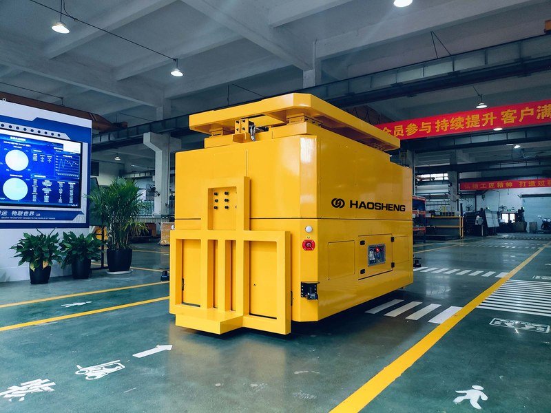
On a heavy AGV, the comparison collapses quickly: floor-mounted media cannot survive the duty, reflectors fight the storage plan, and outdoor legs rule out indoor-only methods. 3D SLAM with RTK fusion is the configuration that covers the whole route list — which is why it has become the default for new heavy-duty projects, from 40-ton screw transporters to 300-ton wind power and 500-ton-class AGVs.
Questions to Ask a Heavy AGV Supplier About Navigation
- Is the SLAM system 3D (full point cloud) or a 2D slice, and how does it behave when floor-level surroundings change?
- Is navigation developed in-house, or bought in — and who tunes it when your plant is the edge case?
- How is the indoor-outdoor transition handled, and can the vehicle cross it without stopping?
- What arrival accuracy is guaranteed at stations, under load, and what fine-positioning closes the gap where needed?
- How are map updates done after layout changes, and can your own staff perform them?
- How do navigation, the onboard PLC, and the scheduling system share data with MES/WMS over TCP or MQTT, on WiFi or 5G?
HENSEN (Hangzhou Haosheng Electric Vehicle Co., Ltd.) designs and builds 3D SLAM laser-navigated heavy-duty AGVs from 1 to 800 tons — reflector-free indoors, RTK-fused outdoors, with omnidirectional steer-wheel drive, in-house navigation and scheduling software, CE marking and ISO 9001-certified manufacturing, delivered across wind power, metallurgy, sheet metal and construction machinery plants worldwide. Tell us your routes, loads, and station tolerances, and our engineers will propose a navigation configuration with a mapped demo plan and budget pricing.
FAQ About 3D SLAM AGV Navigation
Q: Does a 3D SLAM AGV really need no reflectors or floor markers at all?
A: Correct — nothing is added to the building. The vehicle navigates by matching its live laser point cloud against a stored 3D map of the existing structure: walls, columns, trusses and machines. Commissioning is a mapping drive plus route editing in software.
Q: How accurate is 3D SLAM navigation on a heavy AGV?
A: Plan on about ±10–15 mm of positioning accuracy in free navigation. Stations that need tighter placement close the gap with mechanical guides or local fine-positioning sensors at the dock — standard practice in system design.
Q: What happens when the factory layout changes?
A: Everyday changes — moved pallets, parked trucks, people — are ignored automatically because the system matches against stable structure. Permanent changes like a new wall are handled by re-mapping the affected area and updating routes in software, with no site hardware to move.
Q: Can the same AGV work indoors and outdoors?
A: Yes, with sensor fusion: 3D SLAM governs indoors, RTK satellite positioning takes over in open yards, and the two blend through transition zones so the vehicle crosses a doorway without stopping or losing position. Outdoor-capable drives and weather protection complete the package.
Q: Is SLAM navigation reliable enough for very heavy loads?
A: Yes — the navigation does not care about tonnage, and delivered projects run from 40-ton transporters to 300-ton wind power AGVs and 500-ton-class vehicles. What tonnage does change is vehicle engineering: wheel loads on the floor, soft-start drive control, and safety systems such as 270-degree laser obstacle scanners and four-corner emergency stops.
Conclusion
3D SLAM gave heavy AGVs the thing rails could never offer and reflectors only half-delivered: precise position everywhere, with zero infrastructure. A full point-cloud map makes the method robust in cluttered, changing plants; RTK fusion carries the same vehicle into the yard; and an honest ±10–15 mm envelope, closed at the dock by fine-positioning, covers real production tolerances. Specify the navigation questions as hard as the payload ones, and a reflector-free heavy AGV will treat your whole site — indoors and out — as one continuous route.

Leave a comment